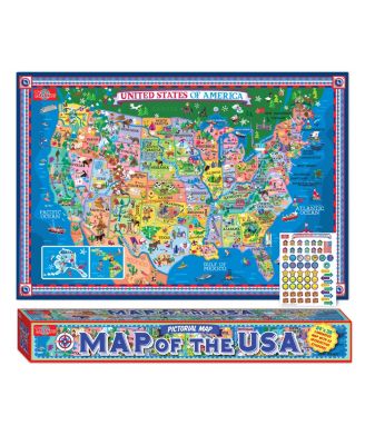
This impressive map includes exciting pictorial illustrations of the nation's landmarks, major cities, bodies of water, key rivers, mountain ranges, architectural and cultural details of capital cities, natural resources and animal life.
Product Features
Dimension- 25" L x 9.5" W x 6.5"H
Illustrated pictorial map of the USA poster
Measures 24"s tall x 35"s wide
The laminated poster has a grommet in each corner
Age- 6 and up
Each in a style rendered in a playful and fun way created to entertain as well as educate
Every element of the map is hand drawn and beautifully illustrated
Warning- Choking hazard small parts, Not for children under 3 yrs